Chesil Beach and the Fleet Lagoon
18 miles and 180 billion pebbles


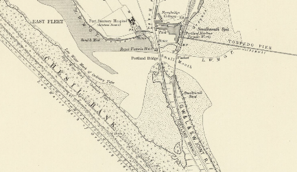
The Fleet is linked to the sea by a narrow channel at Ferrybridge on the south side of Weymouth. The channel enters Portland Harbour and lies across the causeway linking Weymouth to Portland. For many centuries anyone wanting to move between the two had to use a basic ferry and several miles of rough track. The tides through this channel can be very strong making the ferry crossing particularly dangerous with a number of recorded fatal accidents.
The crossing became even more hazardous after the great storm of 1824 when the ferry and ferry house were swept away and the fordable path across the sandbanks removed. In 1835 an Act of Parliament was passed to enable a toll bridge to be built.
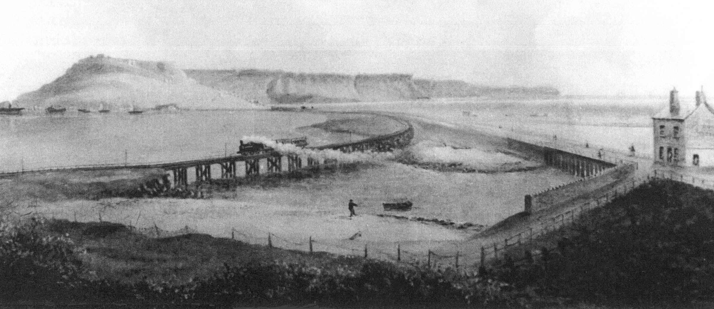
The first bridge was a narrow wooden bridge built on trestles and was approximately 600 feet long.The bridge opened in 1839 with great ceremony. It charged 2d for Portlanders to cross and 3d for non-Portlanders.
It is not clear where the fordable path across the Fleet was located. In the present day the channel is too deep, even at low tide, all the way up to Pirates Cove.
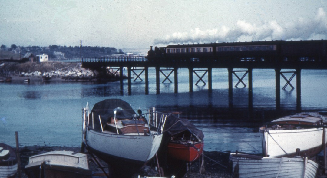
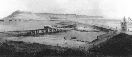
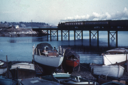
The next bridge to be built was the wooden railway bridge for the Weymouth and Portland Railway Company. Work started in 1863 with completion in May 1864. This bridge was replaced by a metal bridge in 1903 and this bridge survived until the railway closed and the line was removed in 1971.
Print showing the first railway bridge and first road bridge at Ferrybridge.
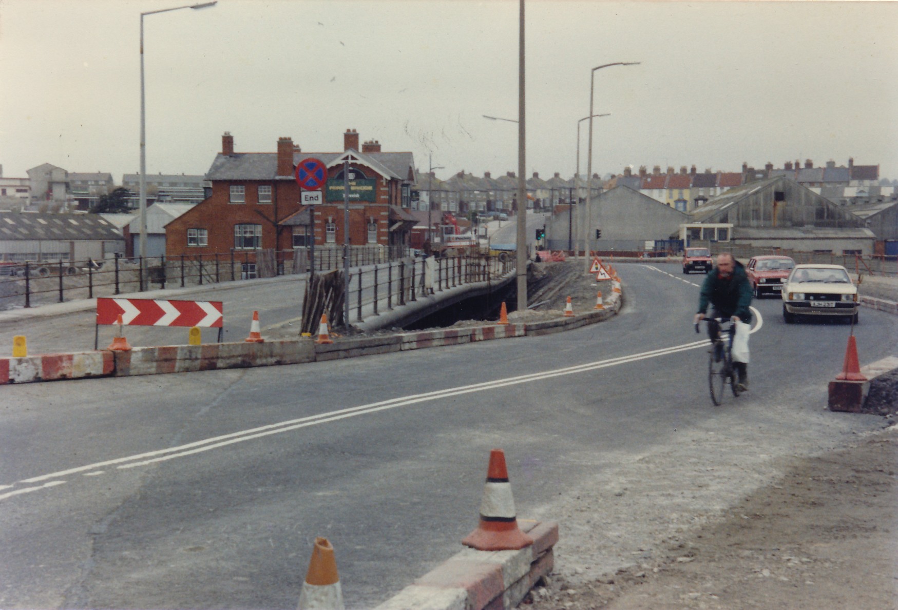
In 1867 the road bridge was shortened to reduce maintenance costs but it was clear that the bridge would need to be replaced, A new iron bridge was built and this opened in March 1896. This bridge lasted for over 90 years and at the end was carrying far more traffic than could have been envisaged when it was built.
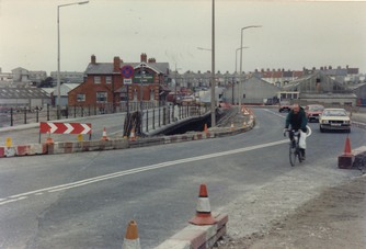
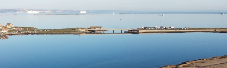
The replacement bridge was built on the Portland side of the old bridge on dry land. On completion in 1985 a new channel was cut through beneath it and the old bridge then removed and the Smallmouth channel filled in.
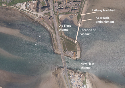
Aerial view of the Ferrybridge area today showing the site of the road and rail bridges. (Picture from Channel Coast Observatory)
The second railway bridge built in 1903.
The temporary road built alongside the old bridge during construction of the current bridge. The undulation that developed in the old bridge can be clearly seen. (Picture: B. Box)