Chesil Beach and Fleet picture gallery
![]()
The Narrows
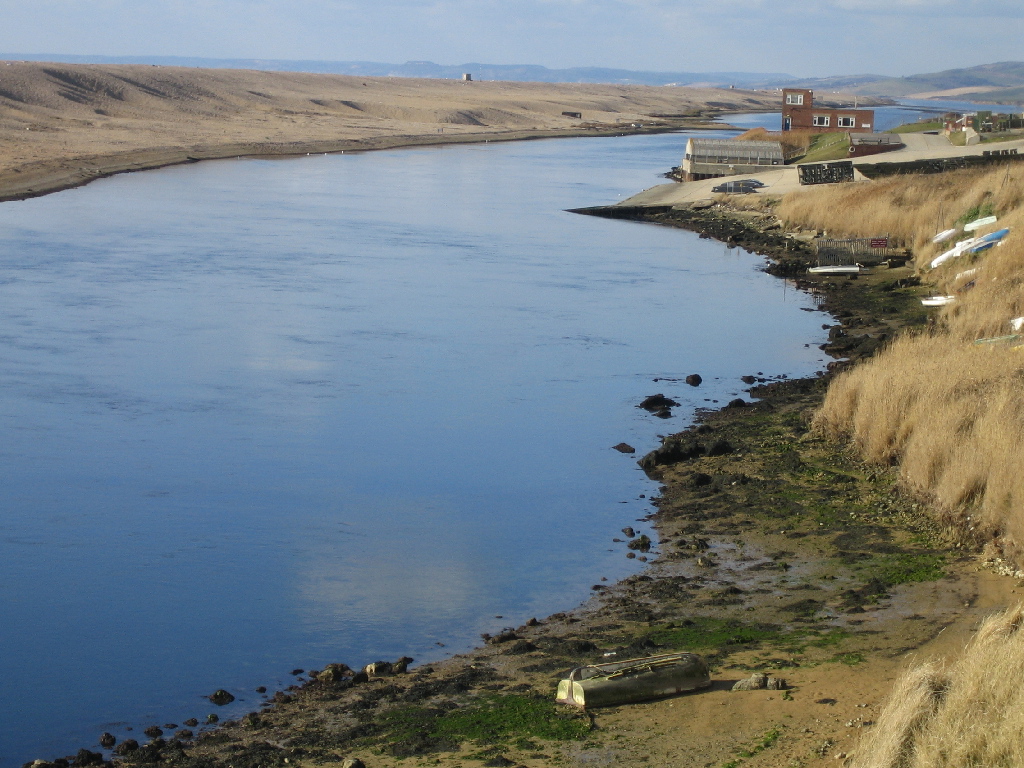
Looking north-west up The Narrows with the Royal Engineers Bridging Camp on the right-hand side. Note the canns on the back of the beach (see below)
SY654770
11/2/2007
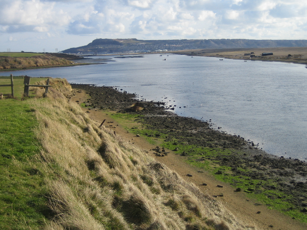
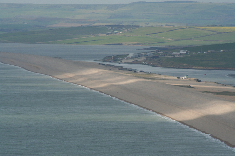
Looking south-east from The Narrows towards Ferrybridge with Portland in the distance.
SY654770
11/2/2007
The entrance to The Narrows from Littlesea. the picture was taken from Sea Barn Hill.
SY624805
11/3/2007
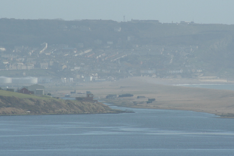
The Narrows taken from near Tout Quarries on the northern side of Portland. Littlesea is the water beyond The Narrows.
SY684728
20/3/2007
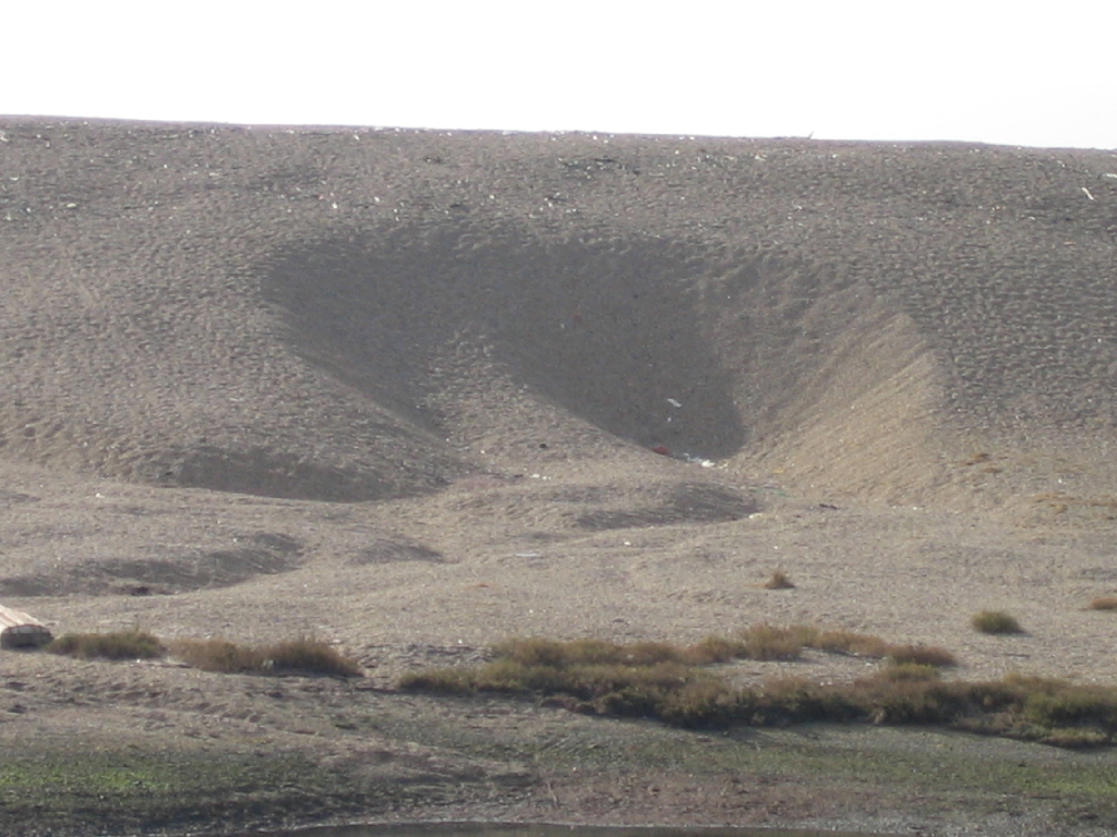
Chesil Beach in The Narrows showing a large cann, a hollow pushed out of the back of the beach by water flowing through from Lyme Bay during a storm.
SY654770
11/2/2006