 |
Postcards from Chesil
Portland 1940-1980
 |
This page shows pictures from Portland at the southern end of Chesil Beach. These pictures continue the sequence from 1940 to 1980. The pictures are arranged in time sequence determined by the progressive development of the area.
Click on an image to see a higher resolution version of the picture.
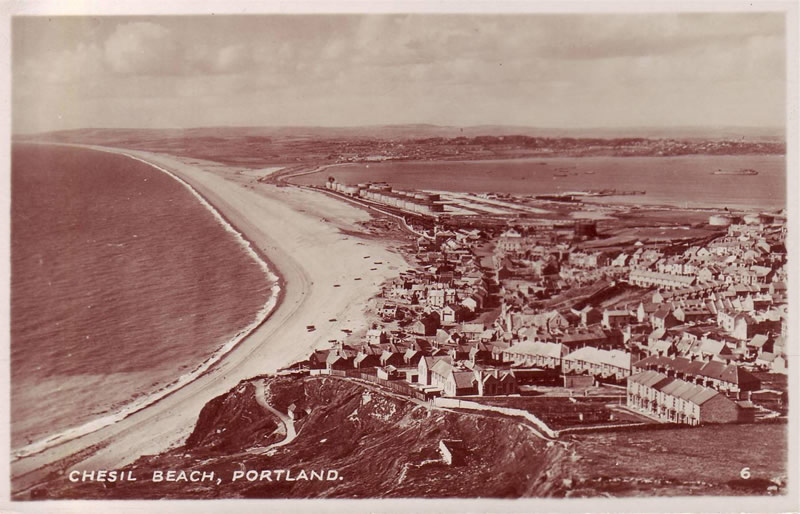
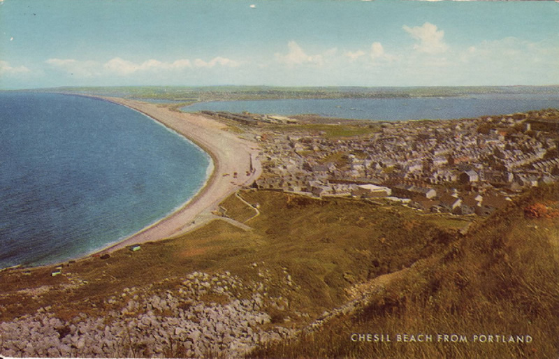
1945?
This picture appears to have been taken just after the Second World War. Two small buildings have appeared in the school playground and may be air raid shelters. The area that is now the Beach Road car park shows very white and was used to hold tanks in the run up to the D-Day landings. All the huts on the Weares have now gone, but a small shelter has appeared on the path just below the school.
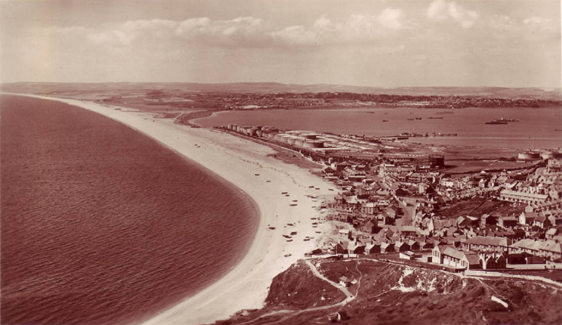
1948?
This card is not postmarked but is believed to have been taken around 1948. A new building has appeared near the oil tanks and the large ditches to the east of the tanks are also apparent. A new pier has appeared going out into Portland Harbour. Two large units are moored in the harbour which may be part of the Mulberry Harbour used on D-Day. The Methodist Chapel in Chiswell has been converted to a workshop with a large door.
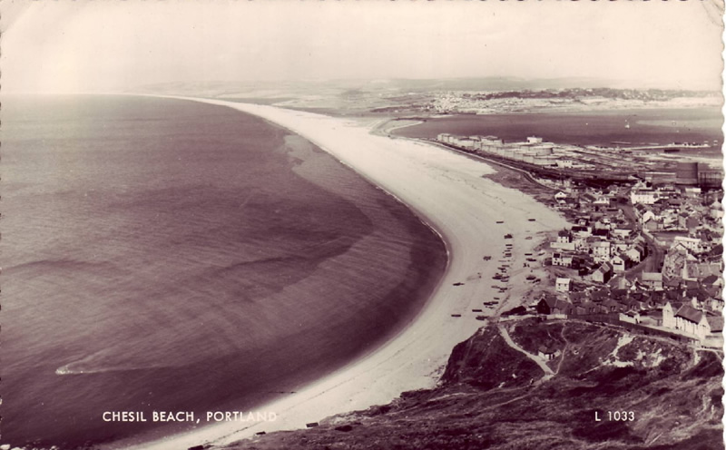
1950?
This card is not postmarked but the print number suggests it may have been taken in 1950. Note the very prominent slick from the sewer outlet! The pump building at the southern end of the oil tanks has appeared and remained until the tanks were demolished. A second gasholder has appeared.
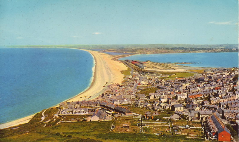
1962?
The date of this picture is unclear but clues suggest it may have been around 1962. The major expansion of the Naval AIr Station had not yet taken place and there were still some vestiges of the railway line. A Nissen hut has appeared on the Weares below the school. The first part of the seawall is in place, but the second part has not been started. This card was the first high-definition colour print and was produced in the USA.
1964?
This card is not postmarked but is believed to have been taken around 1964. There is one hangar at the air station. The whole of the Beach Road car park is in use. Allotments have appeared in place of the fields in the foreground. Both of the gasholders and the railway station have gone. More of the area around the station has been cleared. A crane can be seen working on the extension of the seawall.
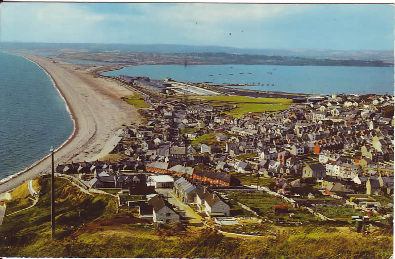
1970?
Not postmarked but believed to have been taken in 1970 or just afterwards. There are two Wessex helicopters on the heliport and the area by the oil tanks that was bare chalk in the previous picture is now grassy.The houses in the foreground are just being built. The Approach radar has yet to be built. Does anyone know what the pole in the left foreground was used for?
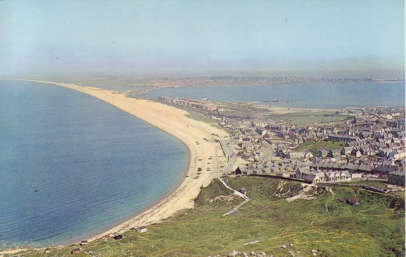
197?
This card is undated and is a poor quality print. The full sea wall is now in place and a hall has been added to the school (1966).
The full runway has appeared at the heliport, along with the first golf-ball approach radar.