

|
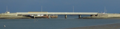
Ferrybridge |
The Fleet connects to the sea via Portland Harbour at Ferrybridge. Originally there was a ferry boat across the entrance to the Fleet but this was replaced by a wooden bridge in 1839. That in turn was replaced by a cast iron structure in 1896 and this was replaced by the present concrete structure in 1985. |
|
|
|
|
Fishing |
Commercial fishing took place for many years on the seaward side of Chesil Beach using nets deployed from lerrets. These days, angling is popular along the whole length of the Beach. In the Fleet, angling is only permitted in the lower Fleet and only from the shore. There is a small commercial fishery for eels in the Mid- |
|
Fleet churches |
There are two Fleet churches, the old and the new church. The old church was partially destroyed in the great storm of 1824 and is now just a chapel. It was replaced by a new church along the road to Fleet House and this is still in use today. |
|
Fleet House SY617806 |
The manor house of Fleet located just south of Herbury. Probably built around 1603 for the Mohune family. Used by American forces during WWII. It was converted to a hotel immediately after the war. |
|
Fleet village SY635800 |
The old Fleet village was located on the shore of Butterstreet Cove and around the old church. Much of this village was destroyed in the great storm of 1824. After the storm a new church and school were built away from the shoreline on the road to Fleet House. The remains of the village are now known as East Fleet. |
|
Fleet Explorer |
Previously known as the Fleet Observer. This is a flat- |
|
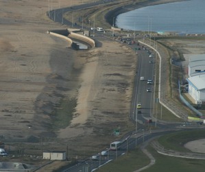
Flood channel |
A flood channel has been constructed along the back of Chesil Beach through Chiswell and along the Portland Beach Road to intercept water coming over and through the beach under storm conditions. Chiswell has suffered severe flooding in the past from over- |
|
Footpaths |
The South- The Hardy Way runs along the northern part of Chesil Beach and the Macmillan Way terminates on Chesil Beach at Abbotsbury |
|
Fossils |
Fossils occur all along the landward shore of the Fleet and along the northern section of Chesil Beach beyond Abbotsbury. Please be aware that parts of the Fleet foreshore are very soft mud. Scientific researchers should contact the Fleet Warden to discuss their intended work. |
|
Freshwater SY478895 |
An area to the north- |