
Chesil Multi-Media Project
Fleet water temperatures
The water temperature in the lower Fleet is measured on a regular basis using a Meteorological Office sea temperature bucket. This measurement is made on each visit to the Black Hut and is made in the same place and, as near as possible, the same time of day. At the same time the sea temperature as measured by the Weymouth Bay Waverider buoy operated by the Channel Coast Observatory is obtained. The Fleet measurement is made on the edge of the main channel at a depth of approximately 1 metre. The measurement is made at approximately 14:30 (local) each time that the CMMP equipment is visited. This is usually at least once a week.
The first plot shows the water temperature in Weymouth bay for the years 2007-2012.
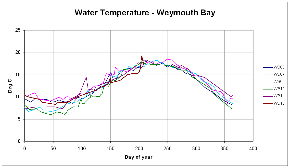
The water is generally at its coldest in late February and at its warmest in mid to late August. The winters of 2007, 2008n and 2012 were very mild and this is reflected in the water temperature compared with 2009, 2010 and 2011. The summer of 2012 has been highly variable. Two warm spells resulted in short-term increases in water temperature but the prolonged cold, wet weather has meant the water temperature is generally below average.
The next plot shows the water temperature measured adjacent to the Black Hut in the Lower Fleet.
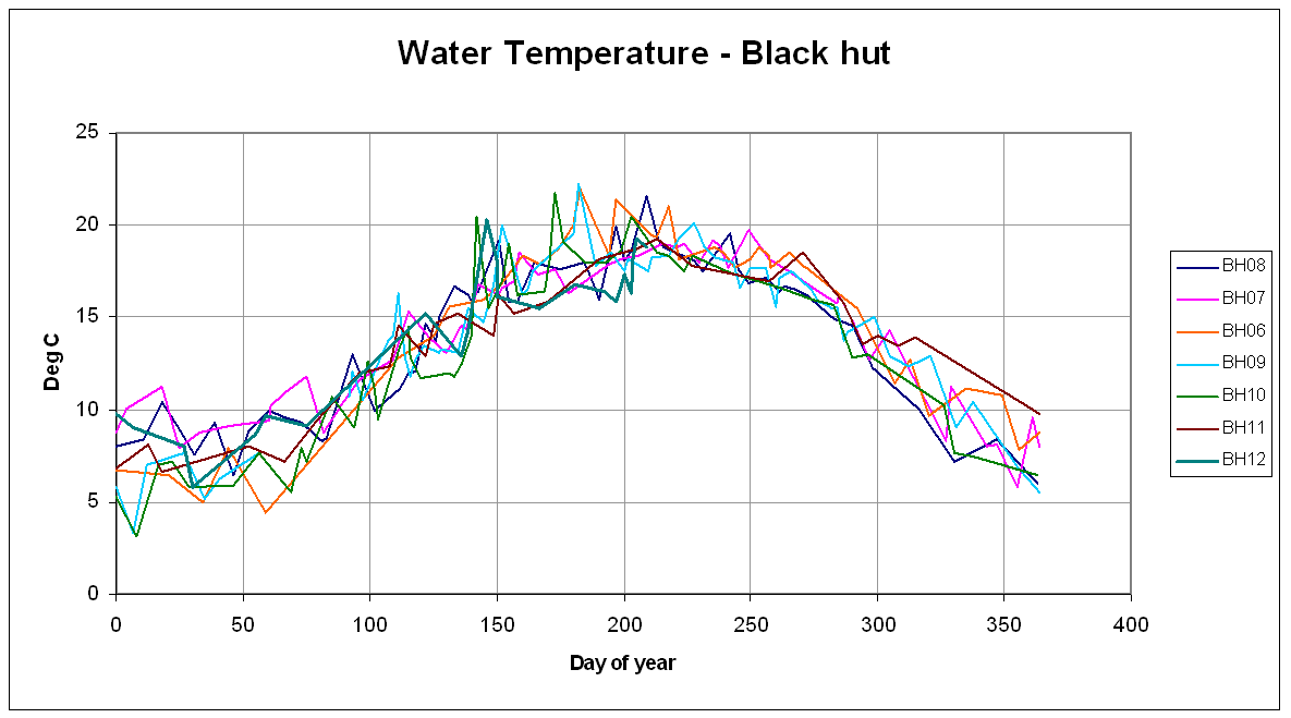 |
The water temperature in the Fleet is more variable than in Weymouth Bay. This is due to the influence of the waters in the Upper Fleet and the effect of the sand flats at Ferrybridge. During an incoming tide the temperature measured will be that of the water coming in from Weymouth Bay via Portland Harbour. On an outgoing tide the temperature measured is that of the water coming down from the Upper Fleet. In the winter this water is generally colder than in Weymouth Bay while in the summer it is usually warmer.
During a spring tide on a hot summer day the incoming water is warmed by flowing over hot sand, while in the winter the water is cooled by flowing over cold sand. On a windy day the surface water is mixed and cooled by interaction.From the plot it can be seen that there can be wide variations in temperature and organisms living in this area have to be able to cope with these changes.
There are three Waverider buoys deployed by the Channel Coast Observatory that measure water temperatures relevant to the Fleet. There is one located just south of West Bay harbour at the northern end of Chesil Beach, one located off Chesil Beach just north of the Narrows, and there is one in Weymouth Bay located off Bowleaze Cove. The temperatures recorded by these buoys at 10:00 GMT (1000Z) each day during 2009 have been plotted in the figure below.
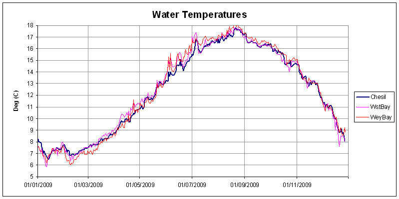 |
It is interesting to note that at times, the temperature at the buoy at West Bay can be up to 1 degree Centigrade different from the Chesil buoy further south along Chesil Beach. The temperatures at both the West Bay and the Weymouth Bay buoys are more variable than at the Chesil Buoy.